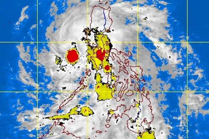
Tropical depression “Ofel” changed track again Wednesday night, and made its fifth landfall over Batangas, state weather bureau PAGASA said Thursday early morning.
PAGASA said Ofel made landfall over San Juan, Batangas at 11 p.m. Wednesday while packing maximum sustained winds of 45 kilometers per hour near the center and gustiness of up to 55 kph.
It earlier made its fourth landfall over Torrijos, Marinduque at 7:45 p.m. It also advanced over Burias Island Wednesday noon, after making its second landfall over Matnog in Sorsogon at 6:00 a.m., and its initial landfall in Can-avid, Eastern Samar at 2:30 a.m.
According to PAGASA’s latest weather bulletin, Ofel’s center was estimated in the vicinity of Lobo, Batangas, while moving northwestward at 20 kph.
The storm is forecast to move west-northwestward over Batangas and emerge over the West Philippine Sea Thursday morning.
Ofel is also expected to remain a tropical depression within the next 12 to 24 hours, but may intensify into a tropical storm while over the West Philippine Sea.
PAGASA said it is likely to leave the Philippine area of responsibility Friday morning or afternoon.
Ofel will bring moderate to heavy rains over the northern portion of Quezon, Aurora, and Bulacan on Thursday.
Metro Manila, Cavite, Laguna, Rizal, Bataan, Nueva Vizcaya, Quirino and the rest of Central Luzon and Calabarzon will experience light to moderate rains, with at times heavy rains, because of the storm, while Mimaropa, Western Visayas, Central Visayas and most of Mindanao will have similar weather conditions due to the southwest monsoon, according to PAGASA. (abs-cbn)


